Friday, January 13, 2017


Sheep Island

The Monday after New Year we stayed over- night in Barrow in the Lake District so we could walk another 2 islands in the morning. Low tide was at 8.45am so we set off for the smallest, Sheep Island off Walney Island. We had missed it out when we were in the area before as we had been in cycling gear. When we arrived at the tiny car park at Snab Point we were glad of our wellies. It was boggy later but the causeway was puddle ridden and soft sand.

The causeway splits, one path going to Sheep and the other Piel. This route is also the way the landlord of Piel’s pub drives his car to the island at low tide. I am told he is the only one permitted to do so but others try, some successfully and others causing great expense and time to recover vehicles stuck in the mud. It was very rutted and I expect a most uncomfortable ride. We could see faint tyre marks but the tide must eventually obliterate any tracks.

 
Samphire is supposed to grow in the sand about here but the shoots we saw were probably only grass growing. Marram grass made the going hard as you couldn’t see the unevenness of the ground. We constantly stumbled.

could this be samphire??
 
 
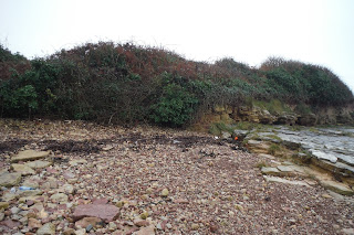
On reaching Sheep Island we had to be content with walking around its perimeter as it was surrounded by a wire fence. A band of shingle edges the island. Almost round, going clockwise there was the remains of a drystone wall and the island seemed to be covered in weeds or scrub.

It was only about a third of a mile to the 15 acre island so in total our walk was only around a mile.

There were views across to Piel with the impressive castle dominating the landscape. To our right we could see the lifeboat house on Roa’s pier


Foulney Island

The wind was cold and getting stronger by the time we reached the causeway to Foulney. In order to get here we had to drive some way down the causeway to Roa Island though this doesn’t get cut off by the tide. We had missed Foulney last time we were here. It is low lying, only 10 feet above high water mark and therefore not easily seen unless you know it is there.

Foulney means bird island and during nesting season parts of it are closed off. At high tide it can be cut off for several hours. We misjudged the terrain here as we wore our wellies. The causeway is mostly stones which after a while you could feel through the soles of the rubber boots. Walking boots would have been much better. We slipped around on the stones too and boots would have given better grip. The stones were varied in shape and size and covered in green slime at the beginning. We could hear oyster catchers and I believe I saw a knot.

We passed a strange orange lifeboat, capsule like with a battered keel and anchored into the sands. Further towards Roa we could see a wreck of a trawler, painted orange to help preserve it as well as act as a warning to its presence.

It was a mile walk along this causeway. I am not sure if the Victorian causeway was actually on top of the mounded wall of rocks, shingle and concrete, beside where we walked. There were huge holes at intervals where the sea had breached it. Some of the rocks looked volcanic in origin being so black. All around were small stones covered in holes rather like pumice.

As we neared the island the rocks became easier to walk on being flat, thin and rounded. Later shingle intermingled with mussel shells led to the grassy bank where we stood at last!

A white tower with AGA printed across it stood at this end of the island, with what looks like a small light for shipping on its top.

We came to an open concrete shed with gear used by the ornithologists when it’s the breeding season. There were piles of stones painted with numbers and letters denoting the names of the birds- RP ringed plover and OY oystercatcher presumably for marking nest sites. There was an upturned comfy chair which looked quite out of place and was exposed rather, to the weather.

The views of Piel and Roa have been good again and we could see that the tide was now incoming. On the sands were flocks of tiny birds-or so they looked from a distance and against a lone seagull. They moved on mass in an undulating fashion like a grounded murmuration.

We came to a large shingle patch, obviously man made, maybe for the ringed plover. Nearby were barricades and notices to be put up during the nesting season.

On the beach above here were chunks of brick building, chimney sized. The bricks had small stones in them which made us think they were at least Victorian in age. Some were completely yellow. The sea couldn’t have brought the bricks but there must have been a building sited here. there was a good view of Piel castle again from here.

We reached the furthermost point and then walked back the other side of the shingle “triangle”. We more or less retraced our steps all the way back to the car. This time the wind was fiercely in our faces and at times it was hard to push against it- perhaps 30 mile an hour.


Tuesday, January 10, 2017


Sully Island


After walking Barry Island we travelled by car to Sully and parked by the Captain’s Wife pub. Low tide was at 11.45 and a traffic light system serves as a high tide warning. The light was green for us at 11.30 and we had over 5 hours to walk across the causeway and back, according to the automatic sign. So many people have been caught by the tide that comes in rapidly (around half a metre every 10 minutes) sweeping visitors off the slippery rocks of the causeway. There is a sign warning you that you may be charged for any rescue mounted on your behalf near the traffic lights.

It is supposed to take 40 minutes to reach the island but I don’t think it took this long despite us gingerly picking our route across the natural paving slabs- a bit like the Yorkshire limestone though it must have been harder than that, being under water so much. It wasn’t covered in seaweed or algae that we could see but we slipped nonetheless. It was easier further out as the rocks supported barnacles, though not a lot, giving some grip to our boots.

We turned right around the base of the island, prepared to walk around Sully’s edge. We didn’t fancy climbing up to the grassy top. As we reached the seaward side flanked by pink stones and crazed grey slabs we easily mounted and found ourselves on a well- made path through lush grass.

We saw fishermen taking advantage of the solitude as we went east to the highest point. Bracken obscured the route across to the other side and then trip wires of bramble viciously attached itself to us and our clothes but we made it across.

There are no buildings allowed on Sully but we understand it was bought recently for £99,000. In the past it has been used by pirates to terrorise the locals. We believe we found the site of the hill fort (marked on the highest point on the map) by the different stones embedded in the grass there.

There are no trees but a few shrubs. Most signs are on the wild side where there are no paths seemingly and no easy route down to the shore. On the way back to the causeway we passed the skeleton of a boat- just its ribs. People we saw on the way over had been told that it was a Viking ship but we think it is maybe 19th or early 20th century. It contains rusting iron parts and is a fair size.


We were quite relieved to reach the “mainland” without acquiring a twisted ankle. It was straight into the” Captain’s wife” for a good meal and a warm in front of the fire. It must have been a substantial house as it had several large areas within and corridors leading off. The story went that the captain took his wife on board his ship and while on the sea she died. Not wishing to alarm or bring bad luck on the superstitious crew he hid her body in a box.  It was only years later after it became a pub that her body was discovered  ( hard to believe) The place had been haunted but this stopped once her body was given a Christian burial. Another story is that the box with her body was stolen by pirates thinking it was treasure. ..

Barry Island

We had a good night’s sleep, good food and service at the Inn. All around it was a bit of a maze as land here becomes developed. It was no good using the sat nav and we drove in circles in the morning trying to find Barry island. Unsure whether to include this in our island list but a local said it should count! Now a peninsula it was an island until 1880s and in 1896 the rail link was completed running along a 250 yards pier structure. Land has filled in at the sides and the docks also link the gap. The only way to Barry Island once was across the mud at low tide or by steamer at high tide!

We found a parking spot where the coaches park for the funfair in the summer.

This is a dog walker’s paradise. Hundreds were on the beach and promenades. We maybe saw 1 or 2 people only without a canine friend. Dogs can’t go on the beach in the summer. They all seemed well behaved! And later we saw they were welcomed by the cafĂ© owners offering dog bowls, dog treats dog beds, love and attention.

It is a lovely sandy bay and we set of left of this following the path, Clements Colley Walk to a viewpoint from where we could see Sully Island over the docks.

The clouds merged with the land- we think Somerset- and it drizzled with rain. Yellow patches in the sky promised better weather perhaps.

We met a couple who said the lady’s grandfather helped build the harbour wall and worked on the tidal swimming pool- now gone. They pointed out the building next to the pleasure park which used to have a skating rink on the first floor-now a children’s amusement area. There must have been a good view from the grand wall height windows. They told us Barry Island is a resort for day trippers not having many hotels. Miners were sent here twice a week on day trips for respite.

We walked by some new houses with great sea views and Bob was taken with the concrete balls protecting the grass verges. We were foiled by dead ends here though many cul de sacs looked promising. Eventually we arrived back at the car and we took the right- hand side of the bay passing the pleasure park that actually looked to be open, with music playing.


Down on the beach the sand was very soft and hard to walk on. Before climbing up the path to the grassy banks- an ancient wild flower meadow- we admired the rock strata edging the beach. Contrasting pink and grey levels could be clearly seen like layers of a gateau. As we walked down towards the sea on the bank edging Whitmore Bay, the name for the beach, we walked into the rain, heads down. It had been a good hours walk of around 2 miles by the time we got back to the car.

Barry Island has the 2nd highest tidal range in the world of 49 feet!


Monday, January 9, 2017


Alney Island


Between Christmas and New Year we decided to tick off 2 more islands, one to complete the years quota and the other to give us a start- motivation for 2017 -as well as a means to shake off the Christmas lethargy!

We stopped at the White Hart in Maisemore near Gloucester for lunch. They kindly let us leave our car there while we did the walk which started just the other side of the bridge yards from the pub. The White Hart seemed a typical village pub, almost empty when we arrived, with a blazing fire in a grand fireplace. Incongruously it was run by a friendly oriental man and doubled as a Chinese restaurant in the evenings though it was typical pub fare at lunchtime.

Alney Island has been formed by the splitting of the River Severn. Turning left from the pub we crossed the 1950’s bridge and took the cycle path. This had warnings that the path was closed due to damage on the bridge which puzzled us as we didn’t need to cross any bridges to go around the island. We decided to give it a go anyway. It was a tarmac path with the river on our right and a busy main road on our left, with a bit of scrubland in between, where bikes were encouraged to make a detour!

We passed a sign that measured the depth of floodwater up to 6 feet then came to the broken bit of the path- Hardly a bridge, more a platform. Rickety planks were positioned over the space so not suitable for wheelchairs but fine if you were careful. People walking the other way told us this had been like this for some time and they wish it would get fixed soon.

The sounds of a pheasant shoot ( most probably) were loud and spasmodic. We caught glimpses of deerstalker hats bobbing behind the trees round the field over the river. After the walk the pub car park full of big people carriers and hearty country types heralded the close of day.

It was under a wide road bridge, concrete and well graffitied then a rather grand bridge built by Thomas Telford in stone spanned the river to our right. Altogether around Alney we counted 10 bridges!

The cycleway went to the left and we walked the footpath around the Nature Reserve- meadowland. There was a field of sedge like plants that had been cut into- maybe used for thatching. From here we could see the cathedral though the view was spoilt by pylons partially obscuring it. Then we reached Lower Parting where the Severn parts around the island and where the Severn Bore can be best viewed-about 2 metres high. We think someone watching it here might get quite wet judging by the high level of the river debris up the banks.

We had to cross several little bridges over what would be marshy ground sometimes though the frosty ground made it firm today. Only where the sun, glorious in a blue sky, impacted on the ground was there a slippery patch of mud. I skidded twice! The sun being low made it difficult to identify birdlife even with binoculars.

The path took us through dry Llanthony Lock, narrow, walled and because it was in shadow, white underfoot. The only building so far was on its banks – the lock keepers house, rather large and now privately owned.

A little further we dipped under a derelict iron railway bridge, rusting to pieces literally. Then we were opposite the dock area and various riverside businesses. A large healthy looking fox caught our gaze and stared back for some time, in between the back of some buildings and the river, obviously his domain.

There were mown grassy areas now and several possibilities for a route but we headed under yet more bridges. As we walked we met a man who said in the 1970s he had worked on this first bridge- a replacement and he never got his holiday pay a fact he still felt bitter about!

We were now in the city of Gloucester and needed to get to the river bank but a fairground’s parking area blocked the way. We walked in and out of a few roads passing a lovely mosaic wall- some people are very creative. Trying to stay parallel with the river we came to the road then a field with a footpath sign. There were many old breed cattle here- bullocks and one highly muscled with a ring through his nose. They weren’t scared of us and blocking our way forward. Their horns looked honed and dangerous. Opting for the tunnel with the lesser beast without the ring we gingerly edged by and only allowed ourselves to breathe again when we had closed the gate on them.

After walking a little further we found ourselves back at the Telford bridge and we knew where we were though we would have preferred not to have retraced our steps at all. We met the same couple returning also, who told us the cattle are big softees, but we saw the rips in the corrugated iron shed which looked very battered and bashed at horn height!

We had been walking about 2 hours and we didn’t have a drink in the pub as light was beginning to fade.We pressed on,our next stop was being the Premier Inn at Barry and Sully Island tomorrow.